March 26-27 and April 10-13, 2010
To go Back at any time,
use Browser’s “Previous Page”
In the interest of keeping cities we visited in their proper section, our narrative backtracks at this point to Vicksburg MS. Our stay in Vicksburg occurred on our way to Texas rather than on the return.
------------------ March 26 ----------------------
Short on time and wanting to visit the Vicksburg National Military Park, we headed first to the Visitor Center. The film and exhibits there really helped us understand the importance of the Union victory at Vicksburg, a strategic fortified city controlling the Mississippi River. Both sides in this Civil War struggle displayed remarkable tenacity and perseverance. Much of the conflict involved trench warfare due to the predominantly hilly ground. Vicksburg was surrounded and under seige for forty days before it surrendered --- with supplies gone and no re-enforcements in sight. The city’s surrender led to complete control of the Mississippi River by Union forces.
Driving through the Military Park, a visitor today sees many monuments erected by the states whose men fought here:
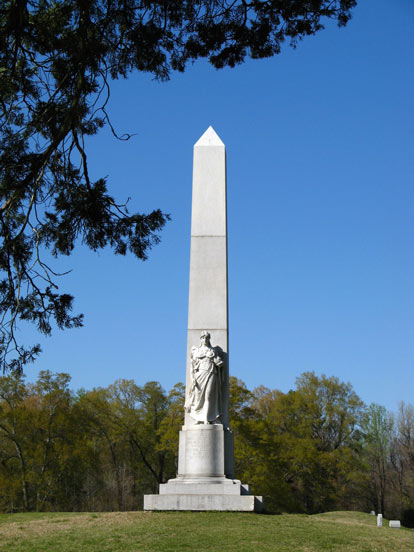
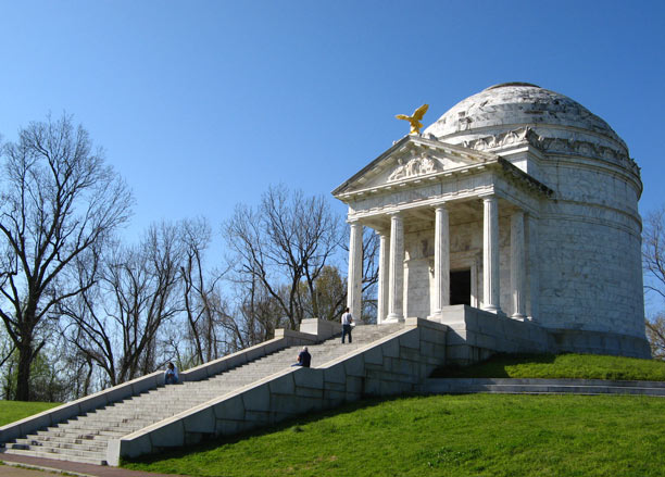
Most are of an obelisk type like this but not all. Of those we saw, Illinois provided the most elaborate:
About to exit the Park at closing time, we were puzzled by this unexpected view of a fabric structure, obviously protecting something:
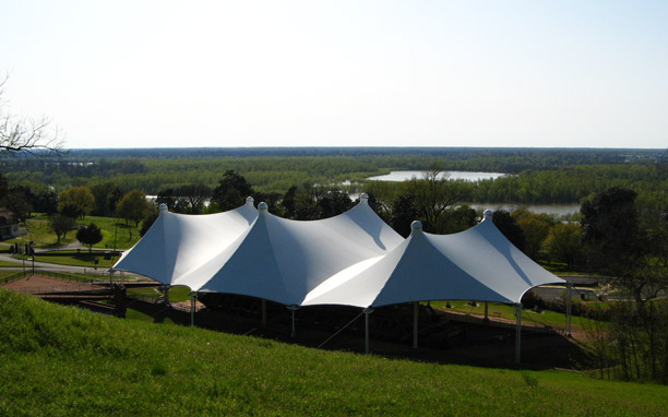
That “something” turned out to be the remains of the ironclad Union gunboat, U.S.S. Cairo:
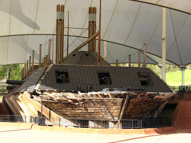
The Cairo had a short life. Built in 1861, she was the first armored warship to be sunk by an electrically detonated mine on December 12, 1862. Over the following years, the gunboat was forgotten and her watery grave slowly covered by silt and sand. Her whereabouts was uncertain in the 1950’s when a historian at the Military Park set out to find her. Although located fairly quickly, the remains of the gunboat, in three separate sections, were not raised until 1964. The display of the partially reconstructed vessel and her artifacts opened at Vicksburg Military Park in November 1980.
------------------ Our narrative now jumps forward to April 10 (after leaving Texas) ----------------------
The drive across central Louisiana to Natchez was not spectacular but it was quite pleasant, partly because of the weather and partly because of the pretty scenery --- lots of crimson clover and other wildflowers, acres of budding corn crops, and good roads that put smiles on our faces. Best of all, though, was the wonderfully blue sky and unusual cloud formations.
Natchez was a bit of a surprise to us compared with expectations. Far from being on the drab side, it possesses some real jewels in the form of gorgeous antebellum mansions, grand views of the Mississippi River and some very pleasant neighborhoods. Had we extra time, we would have explored the town more thoroughly and toured one or two of these mansions. During the so-called “Spring and Fall Pilgrimages,” these old houses are dolled up inside to resemble as closely as possible their former splendor. Of those we managed to drive or walk by, Stanton Hall was, by far, the most elegant:
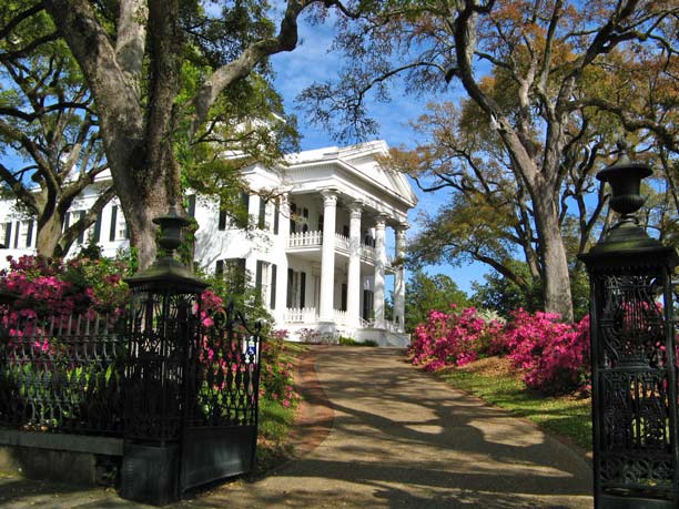
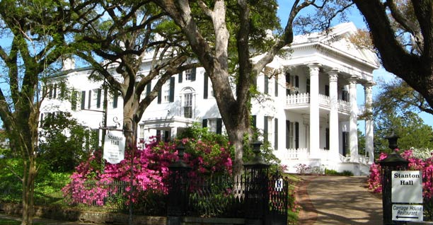
It is a huge structure, too, weighing in as one of America’s largest antebellum mansions. Its extent is more obvious in this shot:
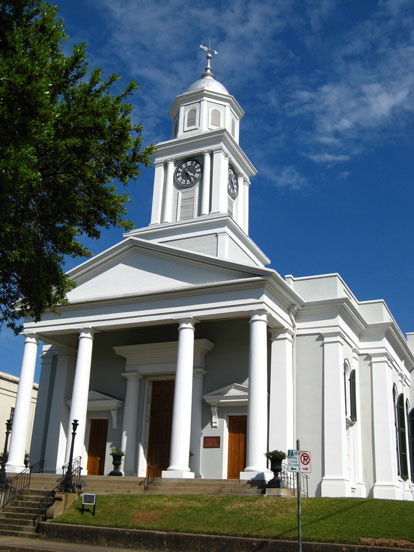
Nearby, we admired the crisp outline of the First Presbyterian Church, built in 1828-29:
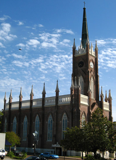
The architecture of St. Mary’s Basilica is unusual, even for a building dating from 1841. This photo does not show it well, but the sanctuary end of the church is circular, reminding us of a boat. Perhaps its floor plan was inspired by the many barges Natchez has seen pass by.
St. Mary’s spectacular interior sparkles as if having been just completed:
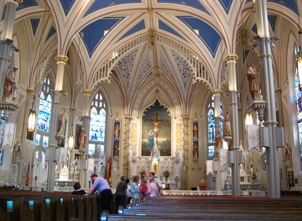
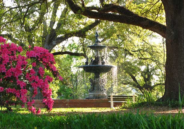
As the old saying goes, they don’t build them like that any more! Behind the church is another beauty spot, a memorial park that reminded us of Forsyth Park in Savannah:
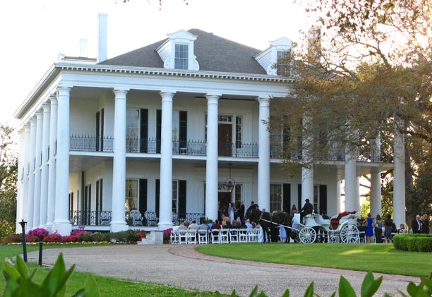
We read that the Dunleith Historic Inn is a popular spot for weddings and wedding receptions. Sure enough, as we cruised by, a wedding was underway:
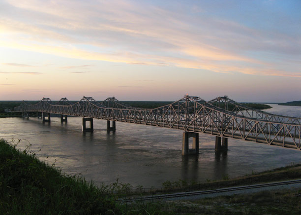
As our brief exploration of Natchez neared its end, we enjoyed the sky at sunset over the Mississippi River, something not possible on the other side (in Vidalia LA):
As appealing as Natchez is in Springtime, we would really like to be here during October’s “Great Mississippi River Balloon Race.” It might be worth a trip from central PA, we think, to enjoy the sight of brilliant hot air balloons floating over Ol’ Man River and over countryside illuminated by fall colors.
Over the next three days, we had the unique pleasure of driving the Natchez Trace Parkway from one end to the other, missing only about 25 miles. There are no services on the road so, unless you bring food and overnight accommodations with you --- which we did not --- it is necessary to leave the Trace occasionally to visit nearby towns. In so doing, it is easy to miss some of the Parkway.
For those unfamiliar with it, here are a few Parkway facts. It is 444 miles long, extending from Natchez MS northeast to Nashville TN. It is a linear park, run by the NPS with no entrance fee. There are no stop lights or stop signs the whole length but the speed limit is just 50 mph almost everywhere. For the last 20 miles or so, approaching the Nashville terminus, the speed limit drops to 40 mph because curves are sharper and more numerous (as below):
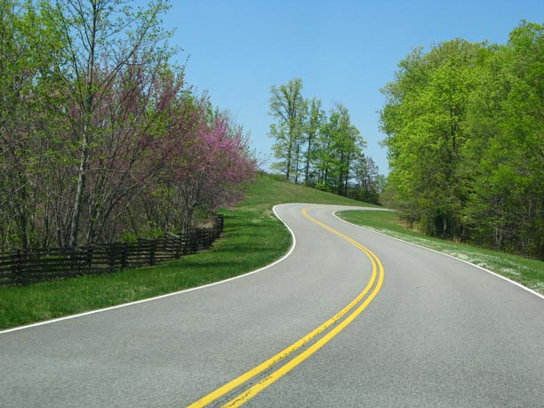
Consequently, those in a hurry tire of it quickly and go elsewhere.
The two-lane Parkway follows (as well as a paved highway can) the old Natchez Trace --- which was essentially a footpath. The old Trace began not as a single trail but a weaving of animal and Indian paths following the quickest and easiest way through the land. Before steamboats, rivermen floated their cargos down the Mississippi, selling their goods at Natchez. Since their boat had served its purpose, they sold it as well for lumber. Then, they trekked back upriver ---- usually on foot --- along old Indian trails that became known as the Trace. The route was later used as a road for carrying mail. With the advent of the steamboat in the mid-1830’s the need to walk back upriver disappeared and a faster way of delivering mail had arrived. Fortunately, the legacy of the old Trace lives on in the form of the Natchez Trace Parkway.
The road surface is generally quite smooth and commercial vehicles are prohibited. The absence of big rigs may account for the fact that we saw not one on-going maintenance project on the Parkway! Compared with the interstate highway experience, at 50 mph your car feels like it’s loafing along, mile after mile. Wind noise is also much reduced. Both effects --- combined with the light traffic we saw --- contributed to a feeling of gentle and peaceful motoring.
There is no paved shoulder on the Parkway but a wide swath of green grass instead on both sides of the road. In some stretches, at this time of year, wildflowers filled the grass in abundance. Blooming dogwoods and red bud trees frequently added their color to the many shades of green from newly-leafed-out deciduous trees and the many dark pines that lined the road. One minute you seem to be passing through a forest with tree limbs pressing in;
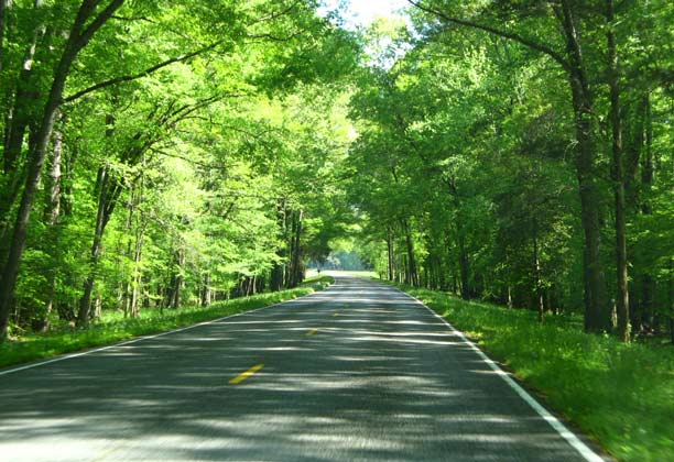
the next minute there is a wide meadow on both sides ringed by forest:
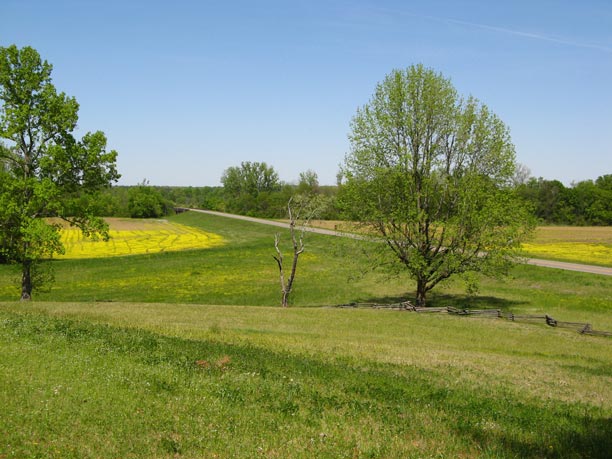
Along the way are many places of interest at which visitors can get out and stretch, have a picnic, learn something new or enjoy a place of special beauty. There are, for example, battlegrounds, springs, waterfalls, short trails through forest and swamps, rebuilt stands (old wayside inns), a huge reservoir at the side of the road --- to name a few. Several of the many stops we made are described below.
Near the Trace are numerous Indian mounds. Some were for burial, some for ceremony and a few had both purposes --- or, so it is believed. We visited and climbed Emerald Mound, said to be the second largest temple mound in the U.S. (Only Monks Mound in Cahokia IL is larger.) Some idea of its scale can be had by observing the hand rail on the right side of the oval mound.
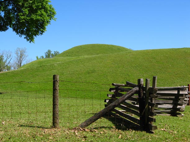
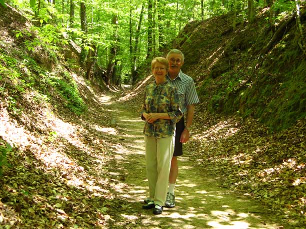
In a few places, the old Trace passed through soft soil that easily wore down over the years from travelers and water erosion, giving the effect of being sunken. Some modern travelers --- perhaps, up to mischief --- are known to hang out in them:
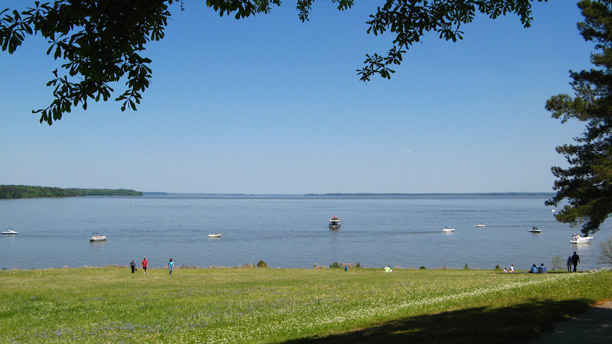
The vast Ross Barnett Reservoir lies just north of Jackson MS, its shores practically lapping the Parkway. It is apparently standard practice for nearby residents to hop on the Parkway, travel to the reservoir and then simply drive onto the grass to park their vehicles. Some folks parked their cars under trees, got out and had a shady picnic with a view overlooking the lake. Others backed their trucks up to the shore and sat in the truck bed, eating, drinking or fishing. Boats probably had to be licensed but there were no fees to use the boat launch ramp. This seemed an all-around good deal at an attractive spot for only the cost of gasoline.
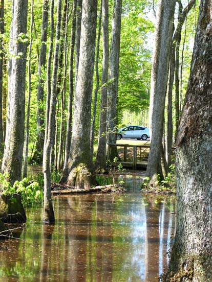
One short walk we took was at a stop called “Cypress Swamp.” Bald cypress and water tupelo trees were the largest swamp dwellers we saw.
In places, it is possible to hike for a considerable distance on the old Trace. It may not be as heavily forested today as it once was but the route is still authentic.

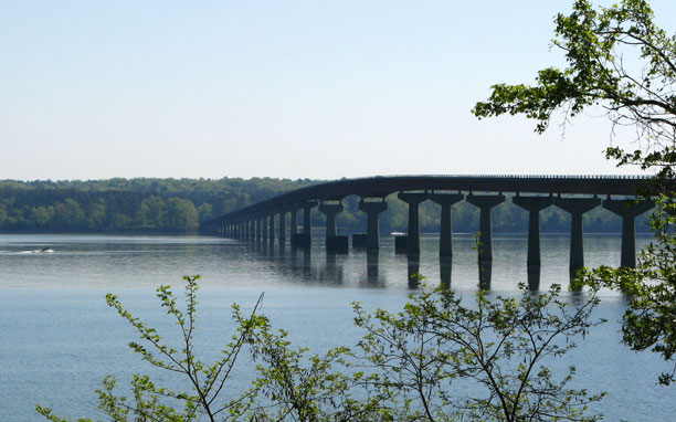
The Parkway does cross one major river, the Tennessee, in the northwest corner of Alabama. Due to dams downstream, the river here is wider now than it was earlier. For travelers on the old Trace, the convenience of a ferry crossing was available for purchase.
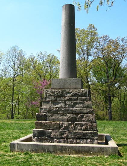
Along the Trace is the grave of Meriwether Lewis, of Lewis and Clark fame, who died mysteriously on the Trace in October 1809. He was only 35 years old. His grave was marked, some 40 years later, by this monument depicting a broken column:
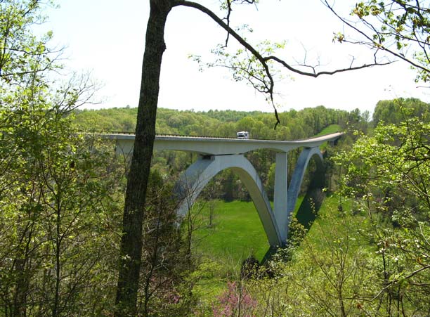
Six miles short of its northern terminus, the Parkway crosses Birdsong Hollow on this double-arched bridge:
A few more minutes of driving and you are in the Nashville suburbs!
Now --- lucky us! --- it’s back to normal streets and roads with all their traffic congestion, signals, stop signs, pot holes and road repairs!